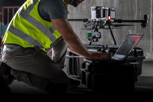
DJI Terra
Tax: Included Shipping: Free
An intuitive, PC-based mapping software developed to help capture, analyze and visualize your environment and transform real-world scenarios into digital assets.


DJI Terra
Make the World Your Digital Asset
Digitize the World Around You
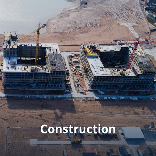
Construction
Collect, measure and analyze data with accuracy across projects
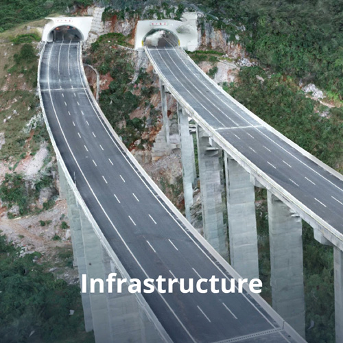
Infrastructure
Easily perform detailed inspections on complex assets and structures
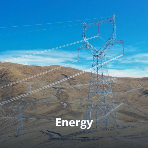
Energy
Safely inspect vertical assets and structures, with special optimizations for power lines

Public Safety
Achieve rapid turnaround time for gathering on-site critical information
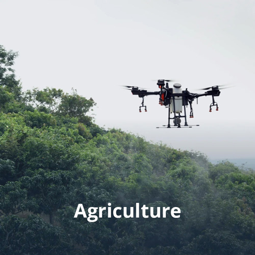
Agriculture
Get an in-depth understanding of your field to help you generate greater yields
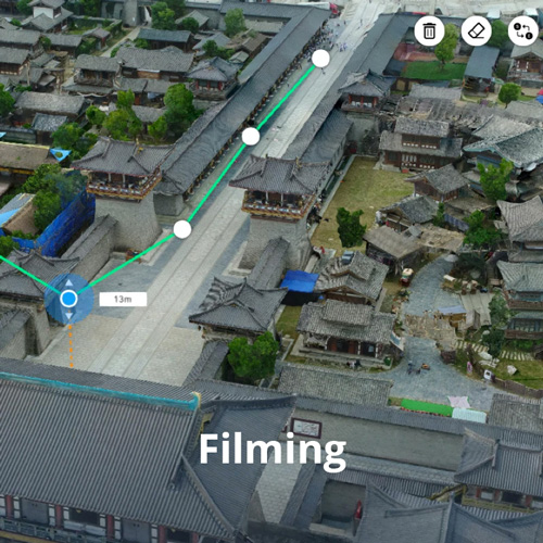
Filming
Optimize previsualization to improve planning workflows across your team
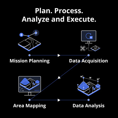
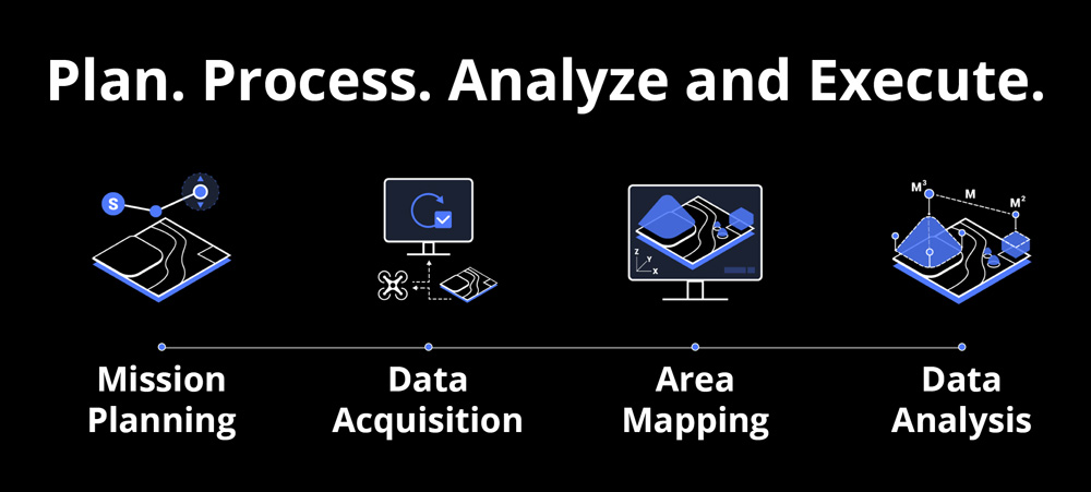
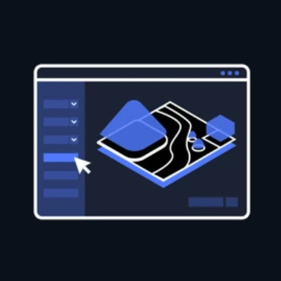
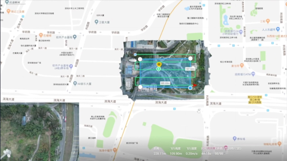
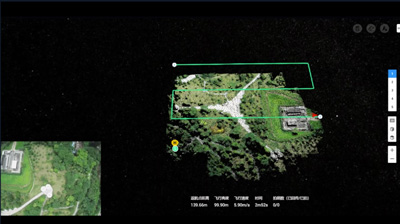
Mission Type
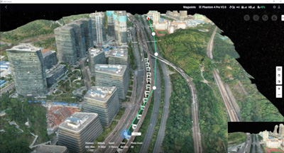
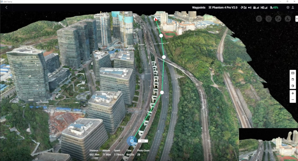
Waypoints Mission Planning
When accuracy is essential and details are vital to your critical operations, Oblique lets you capture a rich 3D model data set by adjusting the angle of the camera at a tilted angle, giving you an extra crisp view of the asset.
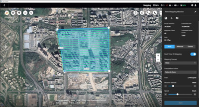
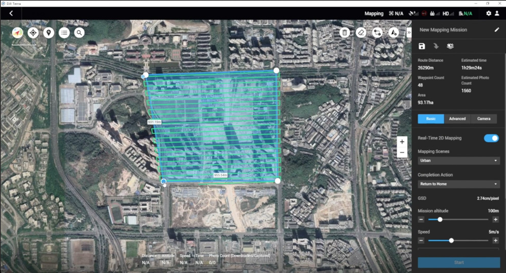
Area Mission Planning
With just a few taps on the screen, you can automate complex missions, allowing you to seamlessly capture imagery which can be processed to produce a variety of maps and models for further analysis, and to aid decision-making.

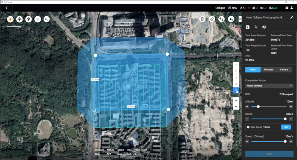
Oblique Mission Planning
When accuracy is essential and details are vital to your critical operations, Oblique lets you capture a rich 3D model data set by adjusting the angle of the camera at a tilted angle, giving you an extra crisp view of the asset.
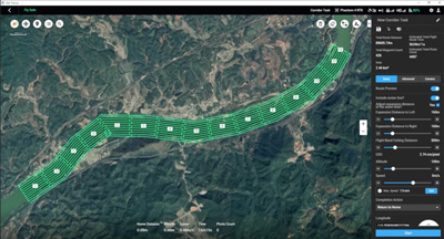
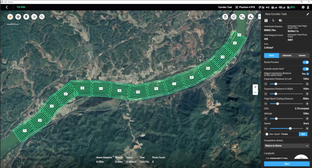
Corridor Mission Planning
Create automated flight missions around roads and railways by simply drawing a line on the map. Adjust mission settings to change the total area mapped, giving you the flexibility to choose between creating high-definition 2D maps and 3D models or quick overviews.
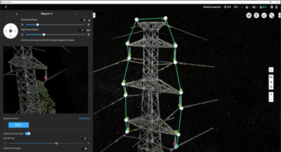
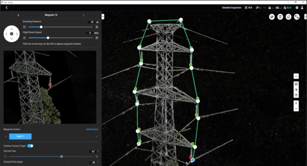
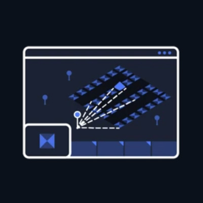
Detailed Inspection Mission Planning
Automatically generate waypoints and flight routes based on one or more points selected in a local 3D model or point cloud (or a third-party point cloud). A simulated camera view including the selected point is displayed onscreen to enable better waypoint selection and more efficient flight route planning, automating inspection workflows.
Seamless Workflows, Accurate Results
Unparalleled efficiency
and user experience
Meet and exceed your
project standards
Compatibility and
flexibility
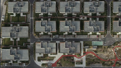
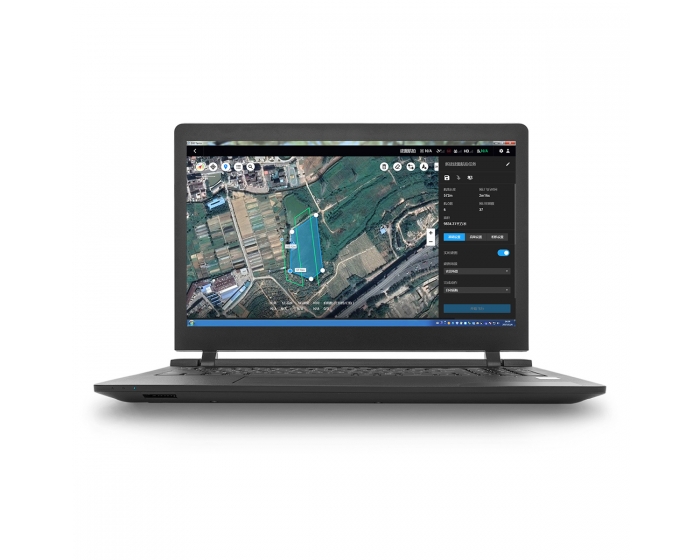
Mapping
2D Maps
Real-time Mapping
Quickly generate a 2D orthomosaic of the selected area in real-time. Not only is this ideal for creating detailed flight paths in remote areas but it’s also useful for time-sensitive missions that require quick decision-making on site.

2D Reconstruction
Generate high resolution orthomosaics, enabling you to get detailed and accurate measurement results for all your critical projects.
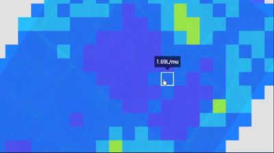

2D Multispectral Reconstruction
Using multispectral data from P4 Multispectral, generate radiometrically calibrated reflectance maps for remote sensing research and more, or produce vegetation index maps including NDVI and NDRE. Create prescription maps for variable rate application using DJI’s Agras drones to improve crop yields while driving down costs.
3D Models

Real-time 3D Point Cloud
When efficiency is key, quickly render and visualize a 3D point cloud of the mapped area. Make decisions based on the preliminary model and check for completeness immediately or plan 3D flights on-site.
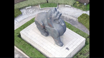
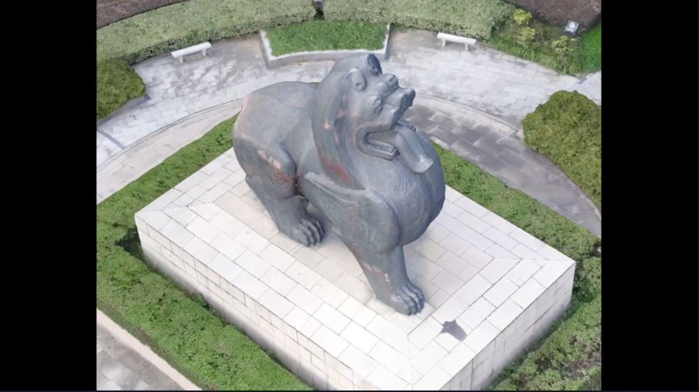
3D Reconstruction
Get sharp and realistic representations of your surroundings throughout various industrial applications, be it accident reconstruction, recreating thin power lines and complex vertical structures, managing major construction projects and more. The CUDA-based reconstruction algorithms are capable of quickly processing large amounts of data to deliver quality results.
With Region of Interest, image reconstruction can be performed to specific target region. In turn, this saves processing time and improves efficiency, while generating a clearer model or point cloud.
Data Analysis

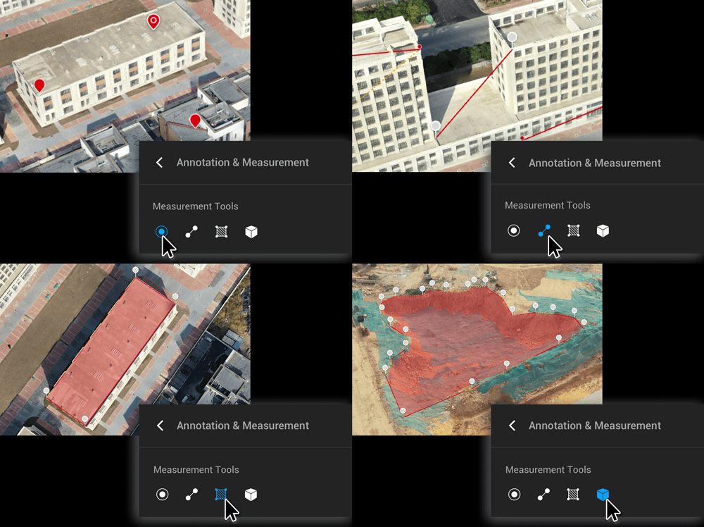
2D & 3D Measurements
Acquire key dimensions across an array of terrains with easy-to-use analysis tools that enable you to obtain a variety of measurement data based on linear, area and volumetric measurements.
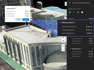

Annotation
Edit labels of measurements on existing models, which can be used for reporting and improving communication throughout ongoing projects
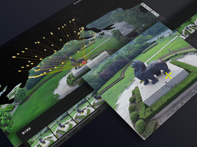

Photo Inspection
Closely inspect every photo of the model so you can pinpoint and highlight any critical elements in the real world.
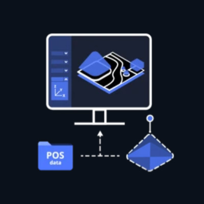
Seamless Connection with Your Fleet of DJI Drones
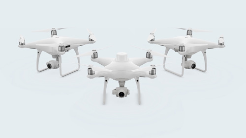
Use DJI Terra to plan and execute flights for:
Phantom 4 RTK (Remote Controller)
P4 Multispectral
Phantom 4 Pro V2.0
Phantom 4 Pro + V2.0
Phantom 4 Pro
Phantom 4 Advanced and Phantom 4
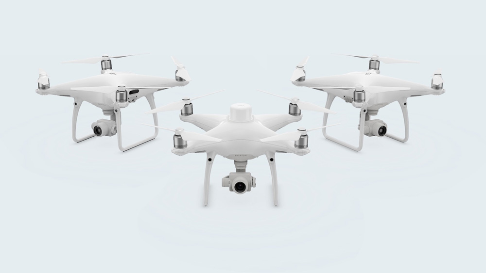
Use DJI Terra to process data from:
Phantom 4 Series drones
Zenmuse P1
Zenmuse L1
Zenmuse X7
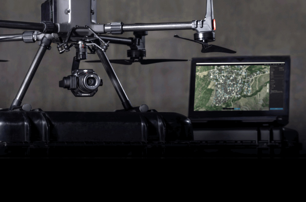
The Beginning of Next Generation Mapping Solutions
Harness the power of AI-driven mapping solutions designed to take your industrial projects to the next level. Whether it’s object classification, site inspections and more, you can start developing task-specific mapping solutions to seamlessly carry out missions.
Data acquisition
Define mission objective, plan desired flight plan, and with a tap of a few buttons, autonomously collect critical data so you can achieve the required outcome.
Data Processing
Utilize refined image recognition technology to generate 2D and 3D data, resulting in a more realistic representation of your assets, objects, surroundings and more.
Data Application
Implement tools and machine learning techniques, which can be used across a variety of different industries – like classification algorithms for identifying trees, objects, and other scenarios.
Execution
Take the required action, and enjoy more efficient processes with machine control – be it automated crop spraying, monitoring work sites, transporting materials and more.
Authorization

Online Mode
Connect devices to the internet regularly to verify permissions and use paid features.

Offline Mode
For users with high requirements for information security, paid features can be used without connecting devices to the internet.
The following online features are not available in Offline Mode:
(1)Unlocking GEO Zones
(2)Map loading and location searching
(3)Without logging into a DJI account, some flight control functions in DJI Terra will be restricted.

Two Fast Replacements
DJI Care Refresh offers up to two replacement units* within one year, giving you total peace of mind.

Comprehensive Coverage
Covers accidents, such as user error and collisions. We’ll replace your aircraft even if it’s water damaged

VIP After-sales Service
Get prioritized support and skilled advice from DJI’s product experts.All shipping fees are covered by DJI.