DJI Zenmuse P1
Tax: Included Shipping: Free
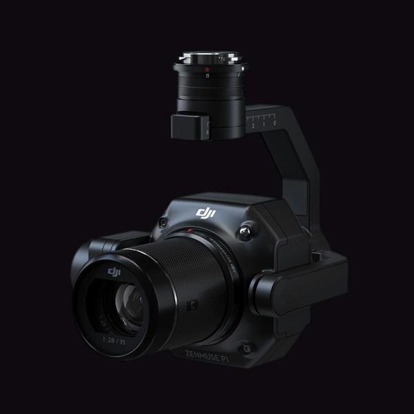
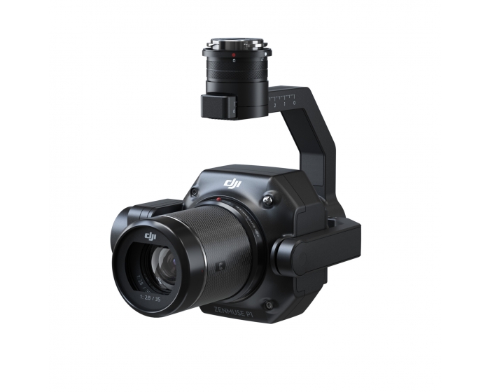
The Zenmuse P1 integrates a full-frame sensor with interchangeable fixed-focus lenses on a 3-axis stabilized gimbal. Designed for photogrammetry flight missions, it takes efficiency and accuracy to a whole new level.
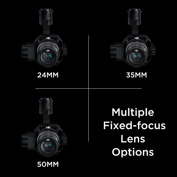
*Note: 24mm and 50mm lens sold separately.

DJI Zenmuse P1
Efficiency through Flexible Full-frame Photogrammetry

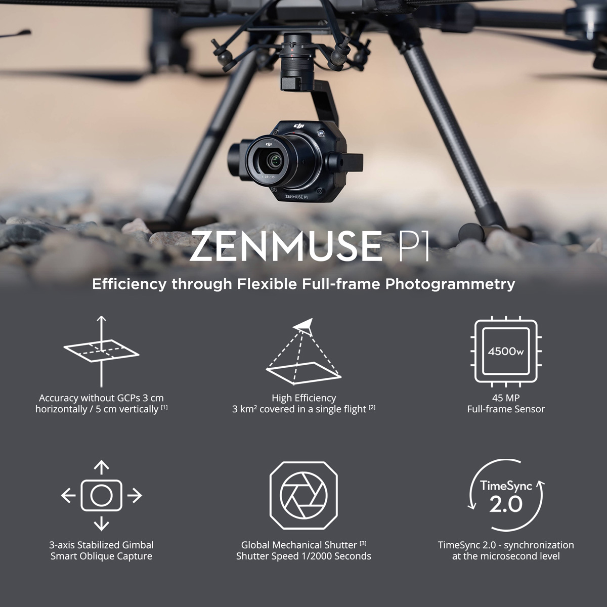
The New Benchmark for Aerial Surveying
The Zenmuse P1 integrates a full-frame sensor with interchangeable fixed-focus lenses on a 3-axis stabilized gimbal. Designed for photogrammetry flight missions, it takes efficiency and accuracy to a whole new level.
Your Go-to Tool for Aerial Photogrammetry
Extraordinary Efficiency
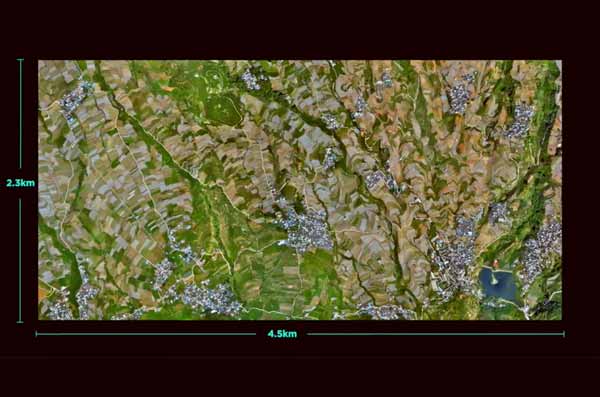
The P1 includes a full-frame, low-noise high-sensitivity sensor that can take a photo every 0.7s during the flight, and covering 3 km2 [2] in a single flight.
Remarkable Accuracy
Equipped with a global mechanical shutter and the all-new TimeSync 2.0 system, which synchronizes time across modules at the microsecond level, the Zenmuse P1 lets users capture centimeter-accurate data combined with the real-time position and orientation compensation technology.
Robust Versatility
Create 2D, 3D, and detailed models thanks to the integrated 3-axis gimbal that can be outfitted with 24/35/50mm lenses and the Smart Oblique Capture feature.
Efficiency to Cover It All
Full-frame Camera
5MP Full-frame Sensor
4.4μm Pixel Size
Low-noise, high sensitivity imaging extends
daily operational time
Take a photo every 0.7 s during the flight
TimeSync 2.0 aligns the camera, flight controller,
RTK module, and gimbal at the microsecond level
Flexibility to Capture It All
Multiple Fixed-focus Lens Options
[3]Global Mechanical Shutter
Sends the median exposure pulse in microseconds
Supports 24/35/50mm lenses with DJI DL mounts
Work Smart, Work Fast.
Smart Oblique Capture
Cover 7.5 km2 [4] in a single workday with the P1. Elevate the efficiency of your oblique photography mission using Smart Oblique Capture, where the gimbal automatically rotates to take photos at the different angles needed. Only photos essential to the reconstruction will be taken at the edge of the flight area, increasing the efficiency of post processing by 20%[5] to 50%[6].
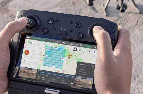
Fieldwork Report [7]
Verify data quality immediately post-flight by checking the position data and number of the images acquired, as well as RTK status and positioning accuracy.
Smart Data Management
Your mission data management - streamlined.
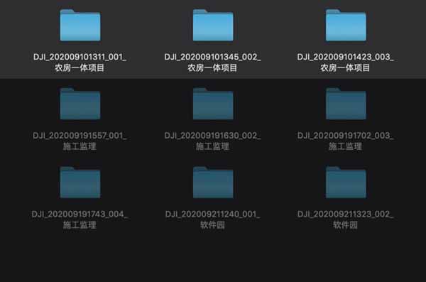
Mission result files are automatically associated with the Mission Name and Mission Time.
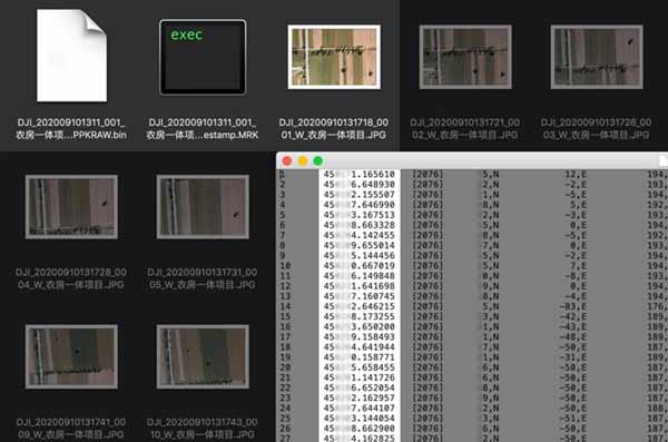
A centralized storage location for photos, GNSS data, and TimeStamps. MRK files.
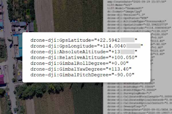
The image metadata contains the camera’s intrinsic and extrinsic parameters and the status of RTK.
A Mission Mode for Any Scenario
2D Orthomosaic Mission
Generate orthomosaics without GCPs using the P1, perfect for medium to large-area operations.
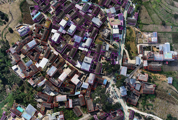
3D Oblique Mission
Effortlessly acquire oblique images from multiple angles that meet 3D modeling requirements across industries such as urban planning and centimeter-level accurate cadastral surveys to serve 3D reality models and smart city planning.
Detailed Modeling Mission
Acquire ultra-high resolution image data of vertical or slanted surfaces from a safe distance that faithfully recreates fine textures, structures, and features, for detailed reconstructions, geological surveys, heritage site conservation, hydraulic engineering, and more.
Real-time Mapping Mission
Gather geographic information of large areas in real-time using DJI Terra so that teams can make crucial decisions quickly on site.
Application Scenarios

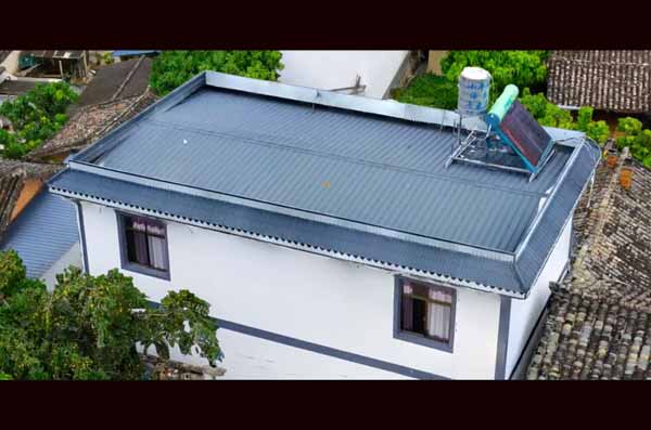
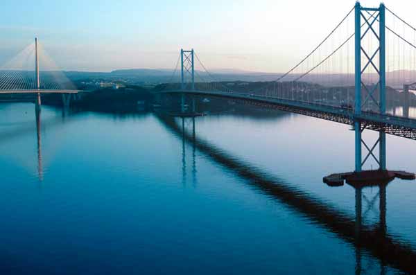
Topographic Mapping
Capture data that meet the 1:500 scale accuracy requirements without GCPs.
Cadastral Surveying
Quickly generate centimeter-level accurate 3D reality models.
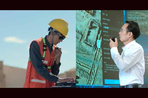
AEC and Surveying
Manage the full project lifecycle with 2D and 3D drone data.
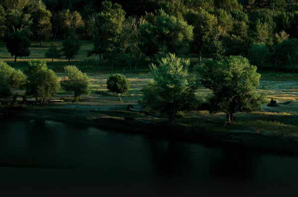
Natural Resource Management
Measure, classify, or determine the ownership of water bodies and forests.
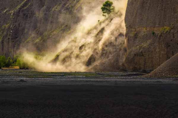
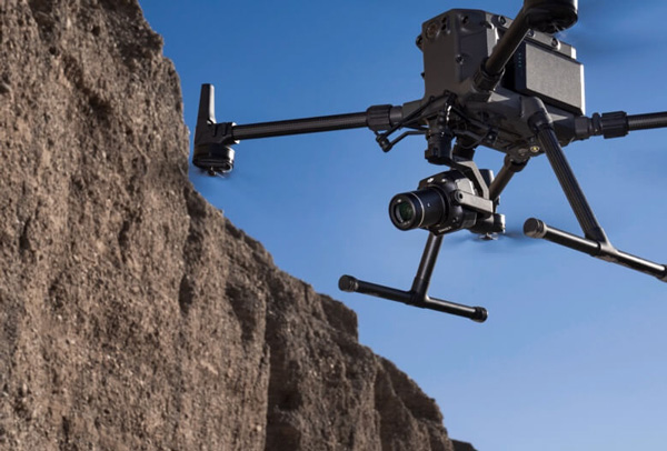
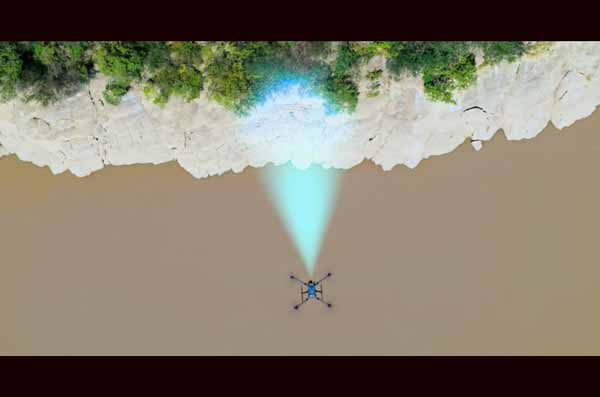
Geological Investigation
Safely gather millimeter-level accurate aerial data of geological hazard sites.
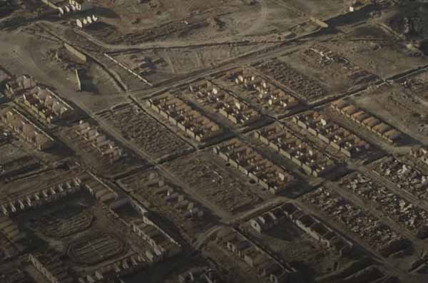
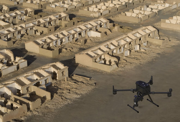
Disaster Site Modeling
Gain real-time overviews of vast disaster-struck areas to help teams make critical decisions.
Notes:
- Using Mapping Mission at a GSD of 3 cm, with an 75% front overlap rate and a 55% side overlap rate.
- At a GSD of 3 cm, with an 75% front overlap rate and a 55% side overlap rate.
- The global shutter is achieved with a central leaf shutter.
- Using Smart Oblique Capture at a GSD of 3 cm, with an 80% front overlap rate and a 60% side overlap rate.
- Area mapped: 1.5 km2, flight altitude: 200 m
- Area mapped: 0.5 km2, flight altitude: 200 m
- Support coming soon.

Two Fast Replacements
DJI Care Refresh offers up to two replacement units* within one year, giving you total peace of mind.

Comprehensive Coverage
Covers accidents, such as user error and collisions. We’ll replace your aircraft even if it’s water damaged

VIP After-sales Service
Get prioritized support and skilled advice from DJI’s product experts.All shipping fees are covered by DJI.